Dimap
About us
Services
Applications for Mining operations
UAV/Drone Survey
Forestry and Environmental Mapping
Mineral exploration and mine mapping
Engineering support
Urban Planning & Development
Equipment
Digital Camera Equipment
Lidar sensor
Thermal equipment
Hyperspectral Instruments
Multispectral Sensor
Operation
Auckland
Kilimanjaro Project
NEWS
Case Studies
Environmental
Asbestos Pollution Mapping – NSW Australia
Dust Pollution Mapping – Namibia
Water Pollution – Hong Kong open seas
Forestry
Usage of full waveform Lidar in forestry taxation
Rainforest Mapping – Malaysia
Ramin Tree Detection – Pekan Rainforests – Malaysia
Urban Forest Tree Mapping – Melbourne
Geotechnical
Dead Sea Potash Production – Dyke stability and water seepages
Glacier Survey
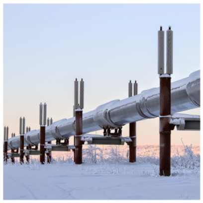
Pipeline Monitoring
Dimap Brochure gas
Dimap Brochure Lacq results
Dimap Brochure Lublin
Mapping of Ramin Distribution
Mine Survey
Airborne Remote Sensing
Further information
CoreSmart(Machine Learning)
Metal Grade Depth Predictor
Radar
Lidar
Thermal analysis
Hyperspectral Theory
Contact us
About us
Services
Applications for Mining operations
UAV/Drone Survey
Forestry and Environmental Mapping
Mineral exploration and mine mapping
Engineering support
Urban Planning & Development
Equipment
Digital Camera Equipment
Lidar sensor
Thermal equipment
Hyperspectral Instruments
Multispectral Sensor
Operation
Auckland
Kilimanjaro Project
NEWS
Case Studies
Environmental
Asbestos Pollution Mapping – NSW Australia
Dust Pollution Mapping – Namibia
Water Pollution – Hong Kong open seas
Forestry
Usage of full waveform Lidar in forestry taxation
Rainforest Mapping – Malaysia
Ramin Tree Detection – Pekan Rainforests – Malaysia
Urban Forest Tree Mapping – Melbourne
Geotechnical
Dead Sea Potash Production – Dyke stability and water seepages
Glacier Survey
Pipeline Monitoring
Dimap Brochure gas
Dimap Brochure Lacq results
Dimap Brochure Lublin
Mapping of Ramin Distribution
Mine Survey
Airborne Remote Sensing
Further information
CoreSmart(Machine Learning)
Metal Grade Depth Predictor
Radar
Lidar
Thermal analysis
Hyperspectral Theory
Contact us
Pipeline Monitoring
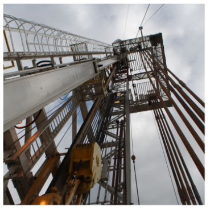
Gas
Lacq-results
Lublin